
In landscape architecture, the use of advanced technology has revolutionized how professionals like myself approach design and planning. One such technology we have added to our arsenal is the Leica BLK360 3D photographic LIDAR scanner. This cutting-edge device offers numerous benefits that enhance the efficiency and accuracy of our landscape design projects.
Complete Capture of the Site
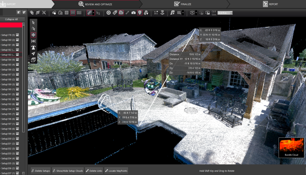
The Leica BLK360 3D scanner can capture a comprehensive view of the site from all angles. This complete capture gives us a level of detail and understanding of the existing conditions that previous methods cannot. We can make more informed decisions during the design process, especially with vertical elements like sloping lots or retaining walls.
High Accuracy
The Leica BLK360 3D scanner is known for its exceptional accuracy. Laser technology captures precise measurements (+/- 6mm at 10m (1/4″ at 30′) from the scanner) and creates detailed point clouds for the site. This accuracy ensures that our designs are based on reliable data, minimizing errors and resulting in a more successful project with significantly reduced changes caused by unknowns or missing information.
External link to the Leica website for our scanner:
https://shop.leica-geosystems.com/ca/leica-blk/blk360/blk360-g1-overview
Integration with 3D Design Programs
The Leica BLK360 3D scanner point clouds integrate with popular 3D design programs like SketchUp. This compatibility allows our landscape architects to import the scanned data directly into our design software. The point clouds enables us to create accurate and realistic 3D models, including preliminary grading designs for the proposed landscape.
Design in Perspective, Plan, and At Any Angle
One of the key advantages of using the Leica BLK360 3D scanner is the ability to design in perspective, plan, and at any angle at the press of a button. This flexibility allows us to visualize our designs realistically, making it easier to communicate and collaborate with clients, contractors, and other professionals involved in the project.
In conclusion, the Leica BLK360 3D scanner offers a range of benefits for landscape architecture projects. Its ability to capture the site from all angles, high accuracy, integration with 3D design programs, and flexibility in design perspectives make it an invaluable tool for our landscape architects. By incorporating this advanced technology into our workflow, we have enhanced the quality and efficiency of our residential landscape designs.
Do you want to see how this technology can help to give you the clarity you need for your landscape design project and significantly reduce the headaches for your contractor?