Introduction
When it comes to landscape designs, accuracy and visual appeal are key factors that can make or break a project. In the digital age, designers have access to a powerful tool called point clouds, which has revolutionize the way we, at Beyond The POST approach landscape design. In this blog post, we will delve into the reasons why using point clouds can greatly enhance landscape designs.
Highly Accurate Designs
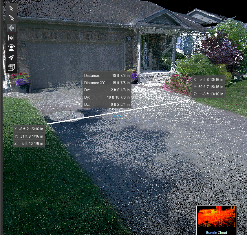
One of the primary reasons we have embrace point clouds in our landscape design process is their ability to provide highly accurate representations of the existing conditions and structures. Point clouds are created by scanning the physical environment using laser technology, capturing millions of data points in three-dimensional space. This data can be used to create precise and detailed models of the landscape, ensuring that the design is based on accurate measurements for every inch of the site.

Stunning Visualizations
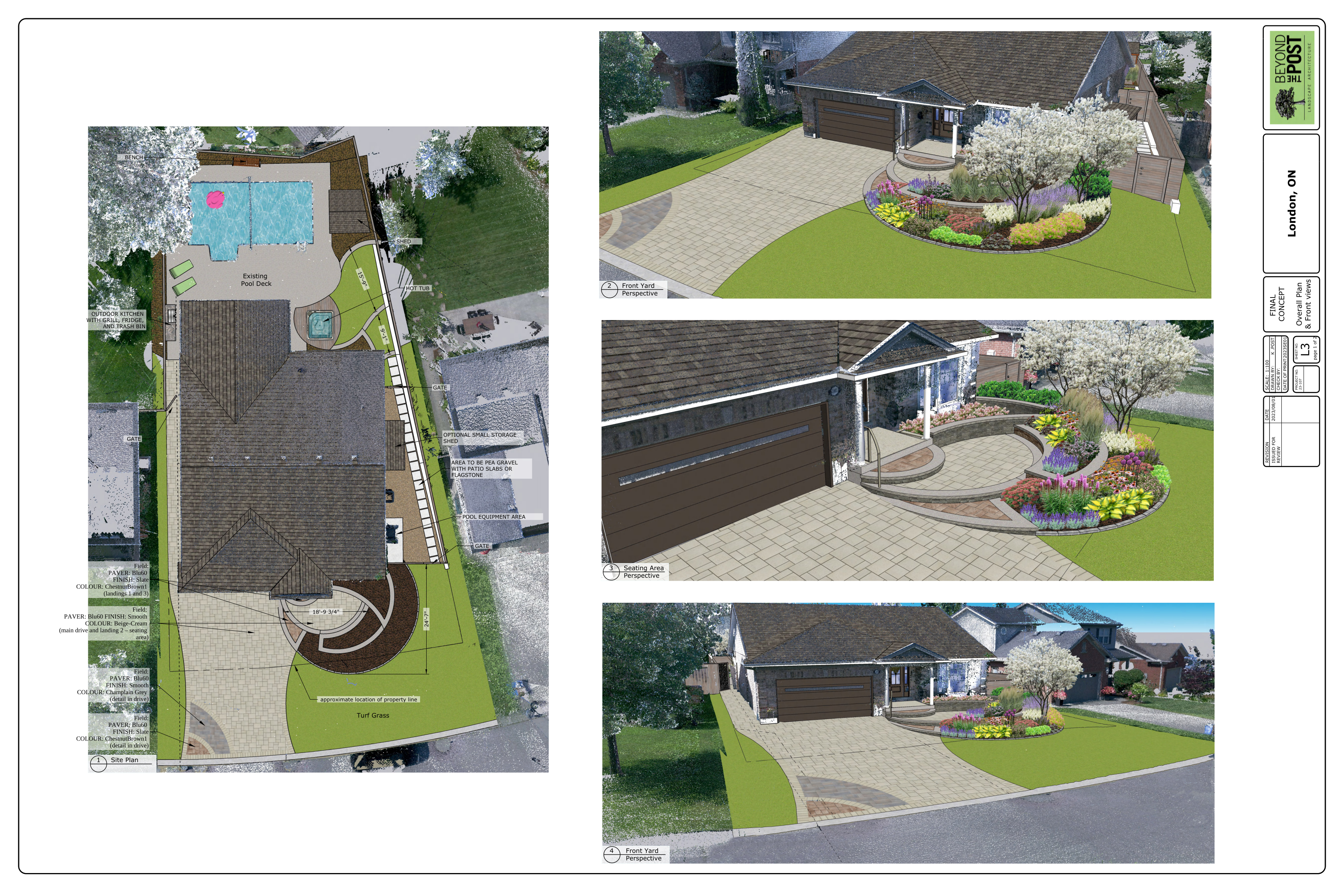
Imagine being able to show the clients a realistic visualization of their future landscape within the surroundings they are familiar with before a single shovel hits the ground. Point clouds allow you to do just that. By converting the captured data into a digital model, we can create stunning visualizations that give clients a clear understanding of how the finished project will look including impacts from the surrounding trees and buildings. These visualizations not only impress clients but also help both them and us make informed decisions about the design, resulting in a higher level of satisfaction.
Reduced Modeling Efforts
Designing a landscape involves considering existing conditions and structures, which can be a time-consuming and labor-intensive task. However, with point clouds, you can greatly reduce the amount of modeling required for these elements. By importing the point cloud data into specialized software, you can automatically generate the existing conditions and structures, saving you valuable time and effort. This streamlined process has allows us to focus more on the creative aspects of design, resulting in a more efficient workflow.
Improved Cost Estimation
Accurate cost estimation is crucial for any landscape design project. Point clouds can play a significant role in this aspect as well. By providing precise measurements and visual representations of the existing conditions, point clouds enable more accurate cost estimation. This helps in avoiding costly surprises during the construction phase and allows for better budget planning. Clients will appreciate the attention to detail and the ability to provide reliable designs of all elements.
Conclusion
In summary, point clouds offer numerous benefits for our landscape architects at Beyond The POST. From highly accurate representations of existing conditions to stunning visualizations for clients, point clouds streamline the design process and enhance collaboration. By embracing this technology, landscape architects can elevate their projects to new heights, delivering exceptional results that exceed client expectations. So, why settle for traditional methods when you can harness the power of point clouds for your landscape design?


